Close to Ottawa is a beautiful example of an escarpment, a transition of one series of sedimentary rocks to another series of different ages and compositions. Think of a sedimentary bed that is first tilted and then eroded on the surface. The different sedimentary rocks weather at different speeds. Escarpments can also form by moving the earth's crust at a geologic vault. Actually, it doesn't have to be the earth's crust, you can find them also on Mars or the moon, but then we call them rupes.
The Eardley Escarpment in Gatineau Park was formed by the first type of process, the more common type. It constitutes the dividing line between the rock of the Canadian Shield, which covers more than half of Canada, and the St. Lawrence Lowlands. It extends over more than 30 kilometers.
I went for a walk to this nearby escarpment with a steep side (some call that a scarp face) and a much more gentle slope on the other side. This steep side, which is 270 meters from the floor of the Ottawa Valley, is sometimes called the scarp face. So a scarp describes a zone between a coastal lowland and a continental plateau with an abrupt elevation change.
The Eardley Escarpment is nature's design for the perfect hike because you can walk up the gentle slope, so you end up at the top of the steep side. This gives you a spectacular view, and you can see the Ottawa River as a thin silver line in the flat green land, far away in the distance.
Its exposure to the south guarantees a unique, hot, and dry microclimate, similar to the forests of the American Midwest. As a result, the white-tailed deer enjoy the protection against the cold northern winds and spend the winter here. The area is also home to many other rare species, like the eastern red cedar; 80 percent of all these trees found in Quebec are located on the escarpment. They are small, but the oldest one found in this area is more than 400 years old.
Together with two friends, I started the walk on the shore of Meech Lake, at the spot where a wealthy Vermont businessman, Mr. Blanchet, once built a farm after a financial setback. It's a pity that his farmhouse is no longer there, they paved this little paradise, and the site is now a small parking lot. All that is left is several of his apple, plum, and pear trees, some of which are still producing fruit. He is remembered because of the trail that is named after him.
The Blanchet Trail is also known as Trail 62, Sentier des Loups, or Wolf Trail. Luckily, I didn't see any wolves, which is no surprise since there are only about eight of them in the park. But did find fresh poop from black bears, which suddenly gave me a new association to think of when reading about Winnie the Pooh. Apparently, that is not only an association by slightly dyslectic non-native speakers, as seen in this half-a-minute video.
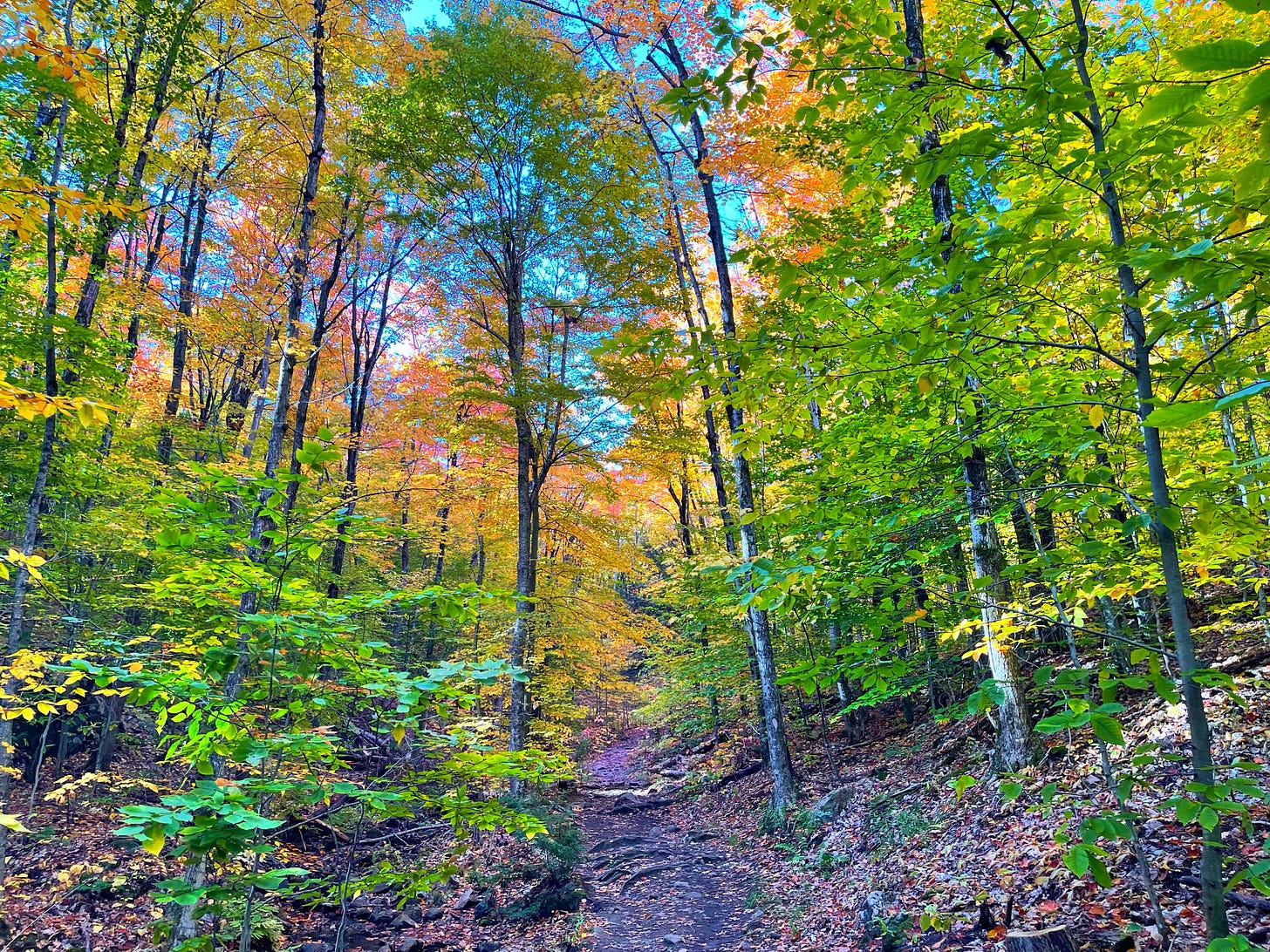
The trail is stunningly beautiful and only slightly challenging, just wear good walking shoes, and you are okay for this nine-kilometer walk. After some 500 meters, the loop trail starts. We chose to take it counterclockwise to have the steeper parts as an uphill climb, which is gentler on the knees while going down.
Since I walked the Camino Frances last summer, I prefer to walk with trekking poles, but I can't fly transatlantic with these as hand luggage, so I left them in Europe for future long-distance walks. You don't really need them here, but if I went here again, I would bring poles if I had them in Ottawa. It gives me better balance and takes some weight off my knees when going down. It may also help to break, or prevent, a fall. Although I never fell during my 700-kilometer walk through the Pyrenees and other challenging routes, I made a painful fall on the street just 100 meters from my house. So I guess it proves my point that I don't fall when I use poles.
The sometimes steep walk uphill was colorful in the autumn foliage. Once at the top, the workout was rewarded with spectacular views over the Ottawa Valley from several lookouts. It is a popular trail, so two other groups also enjoyed the view. Unfortunately, the city of Ottawa is not visible; in the photos, it is on the left but out of sight.
This 90-second video gives an impression of the walk.
If you got this far, please read this too:
I write this newsletter because I believe that together we can do better on this beautiful but fragile planet.
If you are a paying subscriber: thank you for your support!
If you are not, please consider supporting this initiative by taking a paid subscription.
The back page
If you liked this article, you might also like the following:
Some of my Substack and Twitter followers also support my writing and activism for preserving the planet via Buy me a Coffee. I use that platform for some extra posts, mostly shorter, mainly impressions or photos, and perhaps more personal since it is just for a small group. This is an example of a post on Buy me a Coffee.
And this link is where you can become a member.


Thanks for this! Love geography/geology. Fascinating stuff. And that looks like a stunning walk. With that foilage as well. Amazing. Great pictures. And that climb does look pretty steep. I would have done it the same way though. Easier to walk up the very steep parts.
I just can't get over the view from up there. Wow! Thank you for sharing. Helps with not being able to do much myself at the moment.