


Sharing photos, stories, and history of my country


For tonight, no climate or politics, but perhaps you would like to see some photos of the city of Goes?
I have many reasons to love the province of Zeeland; one is its intriguing history, and another is the friendly, cozy towns on the island. Let me add one more: as a geographer, I'm fascinated by the influence water has had on anything that we have ever developed on land. Goes ticks all the boxes: a friendly historic city in Zeeland, shaped by its access to water, trade, riches, war, and geography.
I'll wait to share yesterday's pictures and write more since I don't want to leave you with only one paragraph that raises questions and doesn't clarify what I mean. Actually, there was a logical order in my summing up in that last line. The access to water led to trade, and thus riches, etc.
A bit of history
Let's first go back in time. People lived in this area in Roman times but only returned to this part of the islands around 800. Then, in the tenth century, a small settlement arose on the Korte Gos, a creek on South Beveland. The villagers built their houses on the creek's ridge near the water, a defensible tower, and a church dedicated to Mary Magdalene. This saint is depicted on the medieval city seal.
The village kept growing steadily, and the remainder of the creek became a harbor. The open area between the church and the port functioned as a market field.
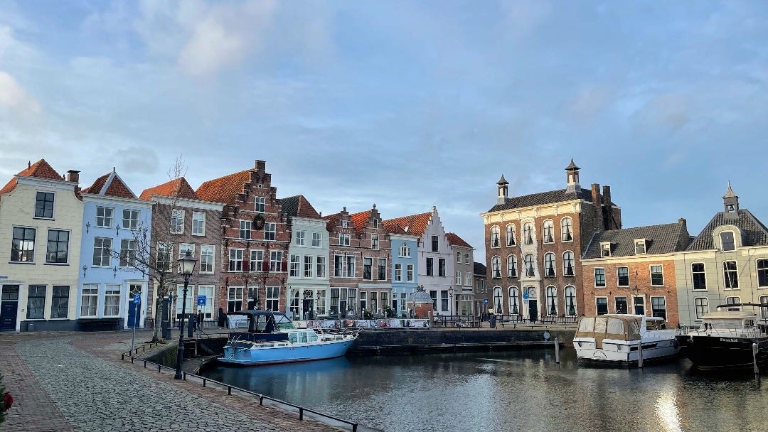
Briefly, we go fast forward to yesterday. I parked my car in a modern car park and walked a short distance to the church. On the vast square in front of the church was the lively market. I walked from the church towards the harbor, passing the cheese and fruit stalls on the market. For more than a thousand years, countless people have known this as the basic layout of the city. However,
Keep reading with a 7-day free trial
Subscribe to The Planet 🌎 to keep reading this post and get 7 days of free access to the full post archives.