


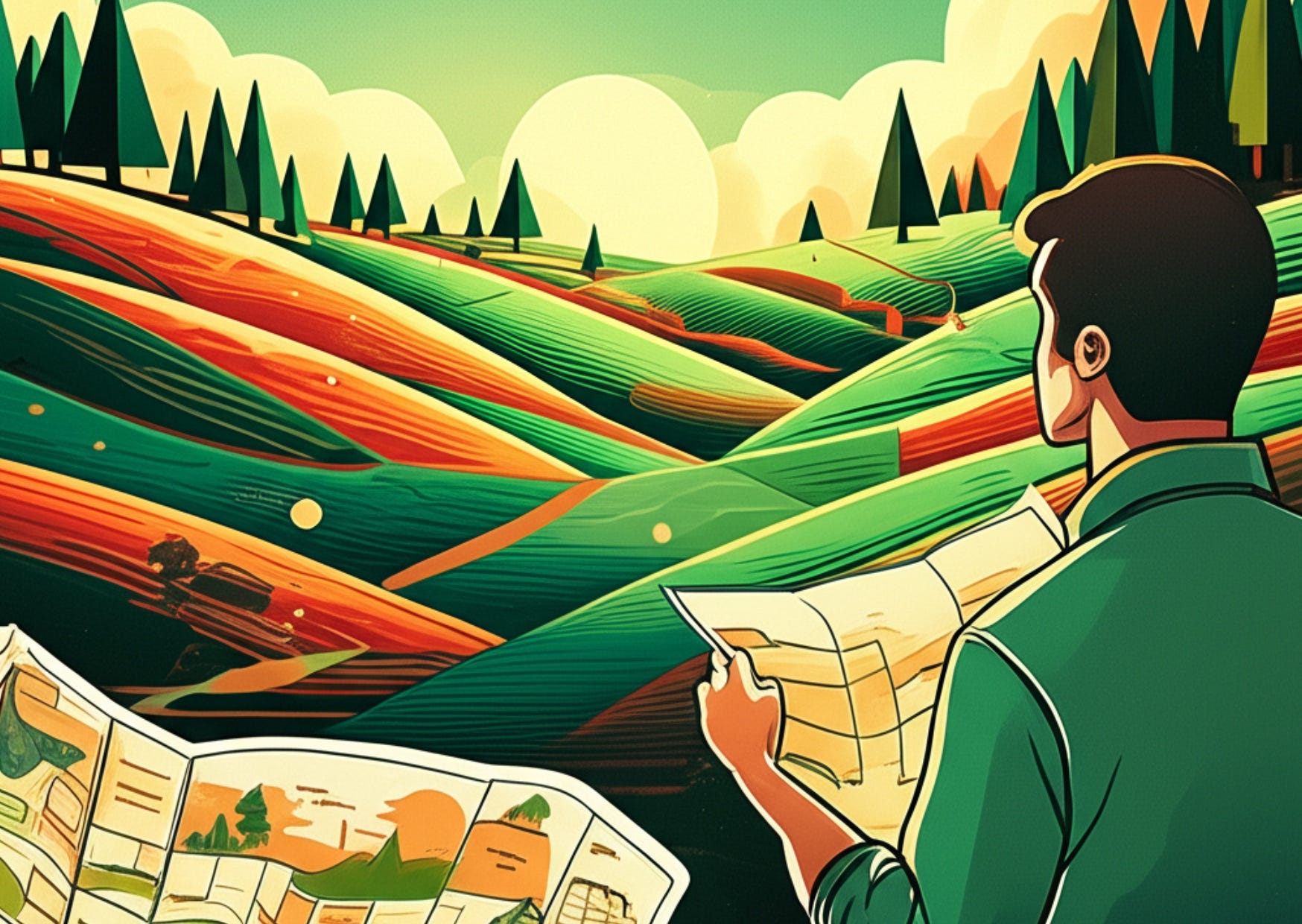
How Geospatial Data Show Us Our Real Environmental Crisis
From Invisible Threats to Visible Solutions

Last week marked a rare pause in The Planet's publishing schedule as I was busy preparing for my keynote speech in Ottawa (where I'm writing from now) and launching a new newsletter.
As you may have noticed, The Planet's articles have evolved over these four years from shorter environmental news takes to more deeply researched, time-intensive pieces. This evolution created space for something I've been experimenting with elsewhere: the more casual, news-oriented writing I previously shared through Buy Me a Coffee.
Technical limitations on that platform led me to create Daybreak Notes & Beans. It is a new Substack newsletter where I offer a balanced review of major headlines alongside lesser-known positive stories, all with my personal perspective. It’s meant to be a quick read during a cup of coffee. It’s not a daily newsletter, which is impossible to do alone for a long time. However, I've been publishing there daily since launch. I suspect many of you might enjoy it alongside The Planet. Have a look here:
Or click here to read today’s article.
I launched it five days ago, and it has already 640 subscribers. I'm still determining how best to integrate these two publications and their audiences. However, I wanted to extend an invitation to explore Daybreak Notes & Beans if you haven't already discovered it.
Today, I'm sharing an article originally published in Gogeomatics Canada for this week's conference. I've included the full text below in the Substack format for easier reading.
The Palm-Sized Power of Precision Agriculture
The democratization of geospatial technology means that a farm manager in Costa Rica can check the exact moisture levels of every hectare through a simple phone app like CropX or Climate FieldView, predict pest infestations weeks before they appear, and track exactly how much carbon her coffee trees are capturing. All from a device no larger than her palm.
These technologies represent a fundamental shift in understanding and protecting our environment as climate change accelerates environmental challenges. The gap between what we can see and what we can't has always shaped ecological decision-making, but now, as the climate crisis demands rapid action, that gap is closing at an unprecedented rate.
My Journey From Dutch Dikes to Digital Maps
Growing up in the Netherlands, where a quarter of the land, home to over 60% of the population, lies below sea level, I learned that understanding geography wasn't optional; it was essential for survival—and today, as climate change poses existential threats to coastal communities worldwide, this understanding becomes even more critical.
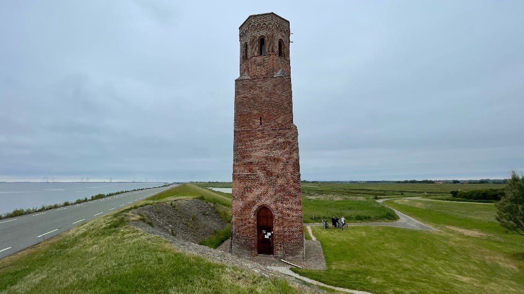
Standing on the dike separating my island of Schouwen Duiveland from the surrounding waters, I overlook a dozen drowned villages; a 16th-century church tower is all that remains of Koudekerke, swallowed by the sea. Understanding how shifting currents invisibly undermined the dikes could have altered my island's troubled history. My studies in Utrecht taught me to read landscapes to see how water, land, and human activity create complex systems. But the tools we had were limited. During my cartography classes in the 1980s, I still had to draw maps on paper.
Revealing Worlds Within Worlds
Today's geospatial revolution recalls another transformative moment in human understanding: the invention of the microscope. Anton van Leeuwenhoek, a Dutch tradesman from Delft, crafted lenses that revealed an entire universe invisible to the naked eye. His "little animals" dancing in rainwater seemed as fantastic to 17th-century minds as today's ability to measure methane emissions from oil wells by satellite must seem to previous generations.
Just as microscopy opened worlds within worlds, geospatial technology reveals patterns and relationships that were always there but invisible to us. The Alberta oil sands remain unchanged, but new satellite technologies transform our ability to address their environmental impact. For example, satellites like GHGSat and TROPOMI now track methane plumes in near real-time, providing actionable data for regulators and the public.
Canadian Challenges Through a Geospatial Lens
I've spent the past four years living in Ottawa, watching Canada grapple with challenges that geographic information could illuminate: the retreating ice roads that connect northern communities, the westward march of forest pest invasions like the mountain pine beetle documented by Natural Resources Canada, the complex choreography of wildlife corridors disrupted by infrastructure. These problems affect real people's lives, livelihoods, and cultural practices.
I'm impressed by the possibilities of technology to transform conservation. Marine biologists off the coast of Nova Scotia now use acoustic buoys to track right whale migration patterns, combining these data with ship traffic monitoring to prevent deadly collisions. According to Oceana Canada, this technology has contributed to reducing whale-ship incidents. The technology's sophistication bridges the gap between immediate economic needs and long-term conservation goals.
Diplomacy in the Satellite Age
This bridging function, connecting different stakeholders and needs, represents a powerful aspect of geospatial technology. In my diplomatic years, I often witnessed competing claims about resources. Whether it was river water allocation, pollution by extractive industries, or carbon sequestration credits, the disputes frequently stemmed from information asymmetry. Those with better data held better negotiating positions.
Consider the long-running softwood lumber dispute between Canada and the United States. For decades, these trading partners have wrangled over forest management practices, with the US claiming Canadian stumpage fees constitute illegal subsidies. Real-time satellite monitoring of harvest rates, carbon storage in standing timber, and detailed mapping of crown lands—technologies available through platforms like Global Forest Watch—could provide objective data for these negotiations. While the technology is available, its adoption in policy negotiations is still emerging. The dispute wouldn't disappear—economic interests would still compete—but discussions could proceed on shared facts rather than disputed claims.
The same principle applies to fisheries management. Today's satellite tracking of fishing vessels through Global Fishing Watch, combined with sonar mapping of fish populations and AI analysis of catch data, provides objective ground truth. These technologies offer unprecedented transparency in an area historically characterized by limited oversight. With verifiable data on fishing activities, nations can shift from arguing about what's happening on the water to developing sustainable management strategies based on shared ecological realities.
Making the Invisible Visible
The environmental applications extend far beyond fishing rights. Consider groundwater, an invisible resource upon which millions depend. In the Prairies, farmers have traditionally relied on local observation and generational knowledge to understand aquifer levels. Now, satellite gravity measurements from NASA's GRACE mission can detect subsurface water changes across entire basins. What took decades of well-monitoring to understand can be mapped in months.
This enhanced visibility carries ethical responsibilities. The question becomes: Who controls the view? Who decides what gets mapped and what remains obscured? Canada's Indigenous communities have pioneered participatory mapping approaches incorporating traditional knowledge with satellite data. Projects like the Nunaliit Atlas Framework and the Mushkegowuk Mapping Initiative demonstrate how, when applied equitably, geospatial technology can amplify local voices rather than override them.
Balancing Access, Security, and Rights in the Age of Transparency
During my time in Ottawa, I observed how the Canadian government grapples with these questions. The promise to make environmental data openly accessible sits alongside concerns about national security and Indigenous intellectual property rights. It's a delicate balance that other nations will also need to navigate as geospatial capabilities expand.
The acceleration of these capabilities continues to astound. Machine learning algorithms now distinguish individual tree species from hyperspectral satellite imagery through projects like ESA's EnMAP satellite. Underwater drones map submerged archaeological sites while monitoring coral reef health. Citizen scientists contribute millions of data points through smartphone apps like iNaturalist and eBird, creating distributed sensing networks that supplement official monitoring. I contribute to insights on biodiversity by uploading data I collect via apps about birds and plants I encounter on my walks.
Bridging the Knowledge-Action Gap
Yet technology alone doesn't save ecosystems. The Amazon rainforest is among Earth's most closely monitored ecosystems, with multiple satellites and thousands of sensors tracking its condition minute by minute through Brazil's INPE satellite system and Global Forest Watch. We can watch deforestation happen in real time, identify the perpetrators, and know precisely how much carbon is released. Still, the forest continues to shrink.
The gap between information and action remains the critical challenge in our race against climate change, and this is where Canada's experience offers valuable lessons. Many Canadian professionals bridge raw geospatial data with policy implementation. Whether it's urban planners integrating climate projections into infrastructure design or conservation biologists using movement tracking to create wildlife corridors, the focus is on translating visual information into tangible protection measures.
The Future of Environmental Protection
Remember the Costa Rican farmer I mentioned in the opening? As documented by agricultural studies, she reduced usage by 40% while maintaining yields through precision agriculture techniques that achieve water savings. Small changes, precisely targeted, add up to significant impacts. Her story exemplifies what I believe is the future of environmental protection: decisions guided by "invisible-made-visible," actions calibrated to the scale of ecosystems, and outcomes verified by the same systems that guided the choices.
The philosopher Simone Weil once wrote that attention is the rarest and purest form of generosity. In their highest application, geographic information systems represent attention at scale, the capacity to notice what matters across vast territories and maintain that attention over time. They allow us to be generous with our care for environments too large or remote for individual stewardship.
The Evolution of Environmental Awareness
The environmental challenges we face are measured in numbers almost too large to comprehend: billions of tons of carbon, millions of species, and thousands of waterways. Geospatial technology doesn't make these numbers smaller, but it makes them addressable. It reveals the places where interventions can have outsize impacts, the patterns that suggest solutions, and the connections that invite collaboration.
Not far from Rideau Hall is a place called Rockcliffe Lookout, a favorite spot of mine to enjoy the view over the Ottawa River as well as to feel the historical significance of that spot. Standing there, I often think about Samuel de Champlain's 1613 map of the Ottawa River—hand-drawn, imperfect, yet essential for those who came after. We are Champlain's heirs, still mapping waterways, still trying to understand our place in the landscape. Our tools have evolved from compass and sextant to radar and AI, but the fundamental task remains: to see clearly so we can act wisely.
The Connected Web of Planetary Awareness
The coffee farmer's phone screen, revealing invisible moisture gradients in her soil, connects to a young Inuit hunter checking ice thickness on a smartphone app, to a flood manager in Winnipeg modeling levee scenarios, to a citizen scientist in Whitehorse photographing permafrost thaw. Each small act of geographic observation contributes to a growing capacity for planetary awareness.
This growing awareness carries a weight of responsibility. We cannot unsee what satellite imagery reveals about plastic accumulation in ocean gyres, methane leaks from abandoned wells documented by GHGSat, and habitat fragmentation dividing ecosystems. The privilege of visibility demands the burden of response.
From Observation to Stewardship
Yet within this responsibility lies tremendous opportunity. Geographic information systems don't just show us problems—they illuminate pathways to solutions. They reveal which wetlands most effectively filter urban runoff, which forest corridors enable species adaptation to changing climates, and which coastal areas can most cost-effectively accommodate sea level rise.
Canada's national geospatial leadership conference, GeoIgnite 2025, will gather again in Ottawa in May. We'll exchange stories of what we've made visible: the underwater forests of kelp that sequester carbon, the urban heat sinks that threaten vulnerable populations, and the migration patterns that cross national boundaries. Each revelation expands our capacity for informed care.
The Responsibility of Vision
The Dutch have a saying: "God created the Earth, but the Dutch created the Netherlands." It's meant as a joke about our endless reshaping of geography but points to a deeper truth about human agency in environmental matters. We are not passive observers of Earth systems but active participants who should act on the best insights available.
When we gather data, create visualizations, and share insights, we expand our capacity for environmental stewardship. We move from reaction to anticipation, from damage control to damage prevention, from protecting what remains to restoring what was lost.
Geographic intelligence gives us the vision to match the scale of our environmental responsibilities, which makes GeoIgnite highly relevant.
The future environment depends not on what we can't see coming but on what we choose to do with what we can finally see clearly. That's the responsibility and the opportunity that geospatial technology places in our hands. How we use it will shape the planet our children inherit.

"The democratization of geospatial technology means that a farm manager in Costa Rica can check the exact moisture levels of every hectare through a simple phone app like CropX or Climate FieldView, predict pest infestations weeks before they appear, and track exactly how much carbon her coffee trees are capturing. All from a device no larger than her palm."
Putting technology to the best use. We need critical thinkers (including you in this description) now, more than ever.
Going on the record, I love Daybreak! Informative and fun. Critical information and the happiest news ☕
How did you know!!!????!?!?!
This is what I did for the feds for ~15 years!!!!
Happy Days!!!!!!!!!!!!!!!!!!!!!!!!!!!!!